
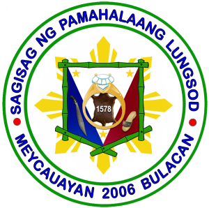
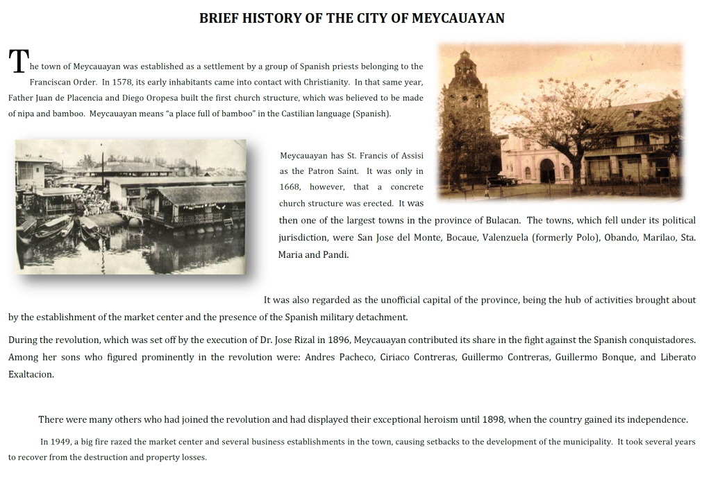
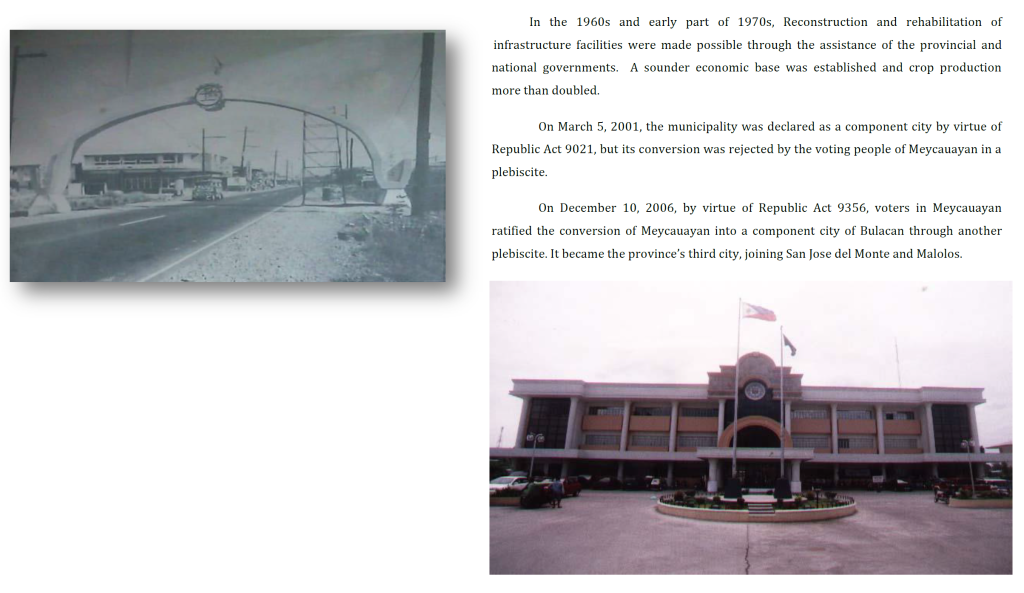
The official seal of the City of Meycauayan which is circular in shape features the four major products of the town set against the background of the Philippine Flag each representing the major industries for which Meycauayan has been noted for, to wit:
| Ring | – for jewelry |
| Hide | – for tanning |
| Wooden shoes | – for wooden manufacturing |
| Bolo | – for blacksmithing |
Inscribed at the center of the hide is the year 1578 signifying the establishment of the town as a settlement by Franciscan Missionaries; while the year 2006 signifies that Meycauayan is officially proclaimed as City of Meycauayan under Republic Act No. 9356.
LGU VISION STATEMENT
Meycauayan, a highly-urbanized green city and the Jewellery Center of the Philippines, is the benchmark of exemplary governance with inclusive social services where citizens are responsible, communities are safe and resilient and the economy is prosperous.
The Local Chief Executive’s 10-Point Agenda, which serves as the City’s mission for the coming years, are as follows:
M – Modernized Jewellery and Leather industry
E – Employment opportunities
Y – Yardstick for exemplary governance
C – Center of Quality Education
A – Attractive business opportunities
U – Urban re-development for flood-resilient city
A – Adaptive and resilient environment
Y – YES to effective solid waste management
A – Action-oriented leadership against crime and disorder
N – Nurturing inclusive growth
SEP QUICK FACTS
| DEMOGRAPHY | |
| Total Population | 225,673(Census 2020) |
| Population Growth Rate | 1.62% |
| Population Density (per sq. m.) | 7,030/km²(CPH 2020) |
| Age Distribution 0-14 15-64 65 and over | Not yet available |
| Dependency Ratio Child Dependency Ratio Old-age Dependency Ratio | Not yet available |
| VITAL STATISTICS | |
| Crude Birth Rate (per 1,000 population) | 11 |
| Crude Death Rate (per 1,000 population) | 4 |
| Total Fertility Rate (number of children per woman) | Not yet available |
| LABOR AND EMPLOYMENT | |
| Labor Force (in 000) | Not yet available |
| Labor Force Participation Rate | Not yet available |
| Employment Rate | NDA |
| Unemployment Rate | NDA |
| Underemployment Rate | NDA |
| EDUCATION (FLEMMS) | |
| Simple Literacy Rate (10 years old and over) | 99.77% (CPH 2015) |
| POVERTY | |
| Poverty incidence of Families | 5.8 %(CPH 2015) |
| Annual per Capita poverty threshold | No disaggregated data |
| Annual average family income (in peso) | No disaggregated data |
| Annual average family expenditure (in peso) | No disaggregated data |
| Annual average family saving (in peso) | No disaggregated data |
| Family Planning Program User | 1,300 couples (CY 2020) SDM (Standard Days Method) 1,668 (CY 2020) WORA (Women of Reproductive Age) CORA (Couples of Reproductive Age) |
Source: PSA, PopCen 2015
2020 Annual Accomplishment Report
GEO-PHYSICAL ENVIRONMENT
Geographical Location
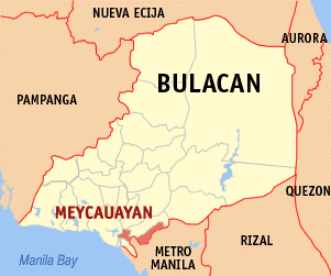
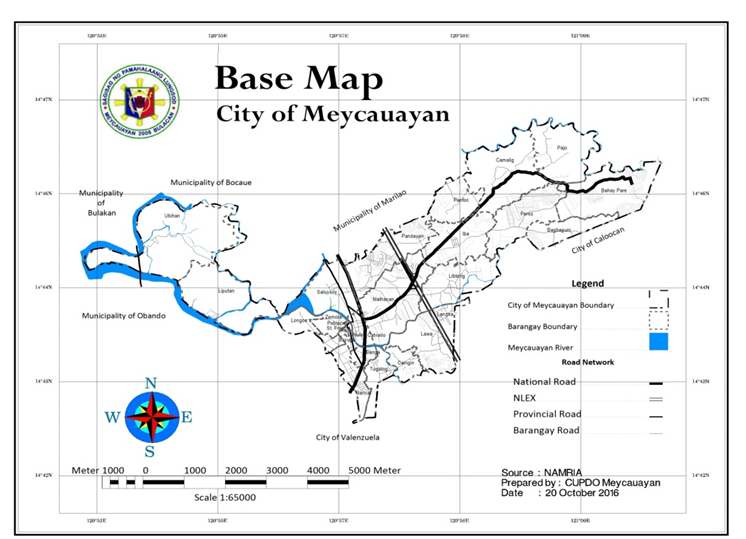
The City of Meycauayan is bordered by the municipalities of Sta. Maria, Marilao, and Obando and the City of San Jose del Monte in the province of Bulacan and Valenzuela City. It is approximately 19 kilometers north of the City of Manila and 22 kilometers south of Malolos, the provincial capital. It is bounded on the east by Caloocan City, on the west by Obando, on the north by Marilao, and on the south by Valenzuela City.
LAND AREA BY BARANGAY
| Name of Barangays | Land Area (in has.) | |
| 1. | Bagbaguin | 92.368 |
| 2. | Bahay-Pare | 235.351 |
| 3. | Bancal | 64.951 |
| 4. | Banga | 25.085 |
| 5. | Bayugo | 18.467 |
| 6. | Caingin | 54.721 |
| 7. | Calvario | 41.496 |
| 8. | Camalig | 245.504 |
| 9. | Hulo | 12.347 |
| 10. | Iba | 156.603 |
| 11. | Langka | 48.968 |
| 12. | Lawa | 130.148 |
| 13. | Libtong | 163.594 |
| 14. | Liputan | 227.759 |
| 15. | Longos | 49.434 |
| 16. | Malhacan | 307.438 |
| 17. | Pajo | 200.382 |
| 18. | Pandayan | 178.719 |
| 19. | Pantok | 101.126 |
| 20. | Perez | 160.821 |
| 21. | Poblacion | 4.172 |
| 22. | Saluysoy | 159.540 |
| 23. | St. Francis (Gasak) | 3.232 |
| 24. | Tugatog | 62.675 |
| 25. | Ubihan | 431.620 |
| 26. | Zamora | 33.479 |
| TOTAL | 3,210.000 |
The City of Meycauayan has a total area of 3,210 hectares which is equivalent to 1.17 percent of the total land area of the province of Bulacan. It is presently composed of twenty-six (26) barangays namely: Poblacion, Hulo, Bañga, Tugatog, Bancal, Longos, Bayugo, Ubihan, Liputan, Zamora, Calvario, Saluysoy, Saint Francis (formerly Gasak), Malhacan, Pandayan, Iba, Camalig, Lawa, Caingin, Langka, Libtong, Perez, Bahay-Pare, Bagbaguin, Pantok, and Pajo.
TOPOGRAPHY
Elevation
The elevation of the City of Meycauayan is presented in Figure . From the Central Business District as the reference point, the inner North-eastern portion of the City which includes Barangays Pandayan, Pantok, Iba and Bahay-Pare has an elevation ranging from 12 meters to 22 meters above sea level. The far-north-eastern portion of the City that includes the Barangays of Perez, Pajo and Camalig has an elevation from 16 meters to 33 meters above sea level. While Barangay Bagbaguin from the far north-east area, is very much distinct among the barangays having the highest elevation of 50 meters above sea level (AMSL).
The central part of the City, composed of Barangays Poblacion, Hulo, Banga, Calvario and Saluysoy, has an estimated elevation that ranges from 3 meters to 5 meters above mean sea level (AMSL) while Barangay Malhacan has an elevation of 10 meters AMSL.
The southern part of the City, comprising Barangays Bancal, Tugatog, and Caingin, is approximately within an elevation of 3 meters AMSL. While the Eastern part, composed of Barangays Lawa and Langka, has an average elevation 6 meters AMSL.
Barangays Ubihan and Liputan in the Western portion of the town have the lowest elevation among the 26 barangays of the City of only 2 meters AMSL. Most areas of these barangays are submerged especially during rainy days.
Slope
The slope map indicates the degree of inclination of a given area. This is expressed in percentage rise of land relative to its ground distance. Generally, the slopes are divided into categories based on the degree of inclination. The slope characteristics are:
SLOPE AND ITS CHARACTERISTICS
| Slope | Characteristics |
| 0 – 3% | Broad level to nearly level land |
| 3 – 5% | Gently sloping areas with land sloping in one general direction |
| 5 – 8% | Gently undulating and rolling land sloping in more than one general direction |
| 8 – 15% | Moderately undulating and gently rolling land sloping in more than one direction |
| 15 – 18% | Moderately undulating and gently rolling land sloping in more than one direction |
| 18% and over | Very steeply sloping and rolling land in many direction |
The City of Meycauayan is generally flat to gently rolling. The slope of the land dips towards a west to north-westerly direction and extend towards west-to-northwest direction. Different elevations or heights characterize its slope; thus, the Northeast portion is greater in elevation than the central part covering the city proper and its environs.
SLOPE CLASSIFICATION OF MEYCAUAYAN, BULACAN
| Description | Slop Range | Area (Ha) | Percent of Total |
| Flat nearly level land | 0 – 1 % | 600.76 | 18.71% |
| Flat nearly level land | 1 – 2 % | 1,374.47 | 42.82% |
| Gently Slopping to undulating | 2 – 5 % | 999.79 | 31.15% |
| Gently sloping to undulating | 5 – 8 % | 234.98 | 7.32% |
| TOTAL | 3,210.00 | 100.00 |
Source: Bureau of Soils and Water Management